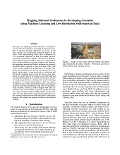
Mapping Informal Settlements in Developing Countries
using Machine Learning with Noisy Annotations
and Multi-resolution Multi-spectral Data

Detecting and mapping informal settlements encompasses several of the United Nations sustainable development goals. This is because informal settlements are home to the most socially and economically vulnerable people on the planet. Thus, understanding where these settlements are is of paramount importance to both government and non-government organizations (NGOs), such as the United Nations Children’s Fund (UNICEF), who can use this information to deliver effective social and economic aid. However, data regarding informal and formal settlements is primarily unavailable and if available is often incomplete. This is due to the cost and complexity in gathering it on a large scale. Moreover, the definition of informal settlements is also very broad, which makes it a non-trivial task to collect data and thus teach a machine what to look for. Due to these limitations we openly provide two datasets with both high and low resolution imagery from a variety of locations, with the accompanying annotations, enabling other machine learning practitioners to compare methodologies. Then we propose an effective end-to-end framework that detects and maps the locations of informal settlements using only low-resolution, freely available, Sentinel-2 satellite imagery with noisy annotations. This is in contrast to previous studies that only use costly very-high resolution (VHR) satellite and aerial imagery. We also demonstrate a deep learning approach to detect informal settlements with VHR imagery for comparative purposes. In addition to this, we show how we can detect informal settlements by combining both domain knowledge and machine learning techniques, to build a classifier that looks for known roofing materials used in informal settlements. We evaluate and compare all three of the proposed methods.
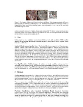
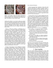
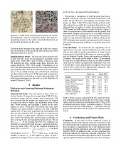
CCF prediction on low-resolution Sentinel-2 spectral imagery.
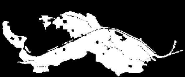
CNN based prediction trained on VHR imagery.
Ground truth mask.
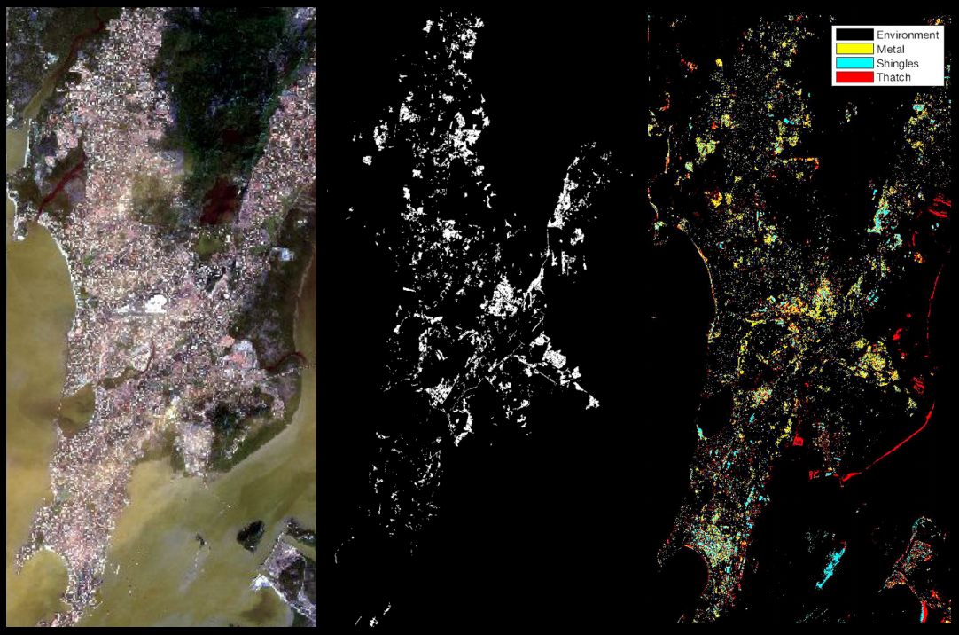
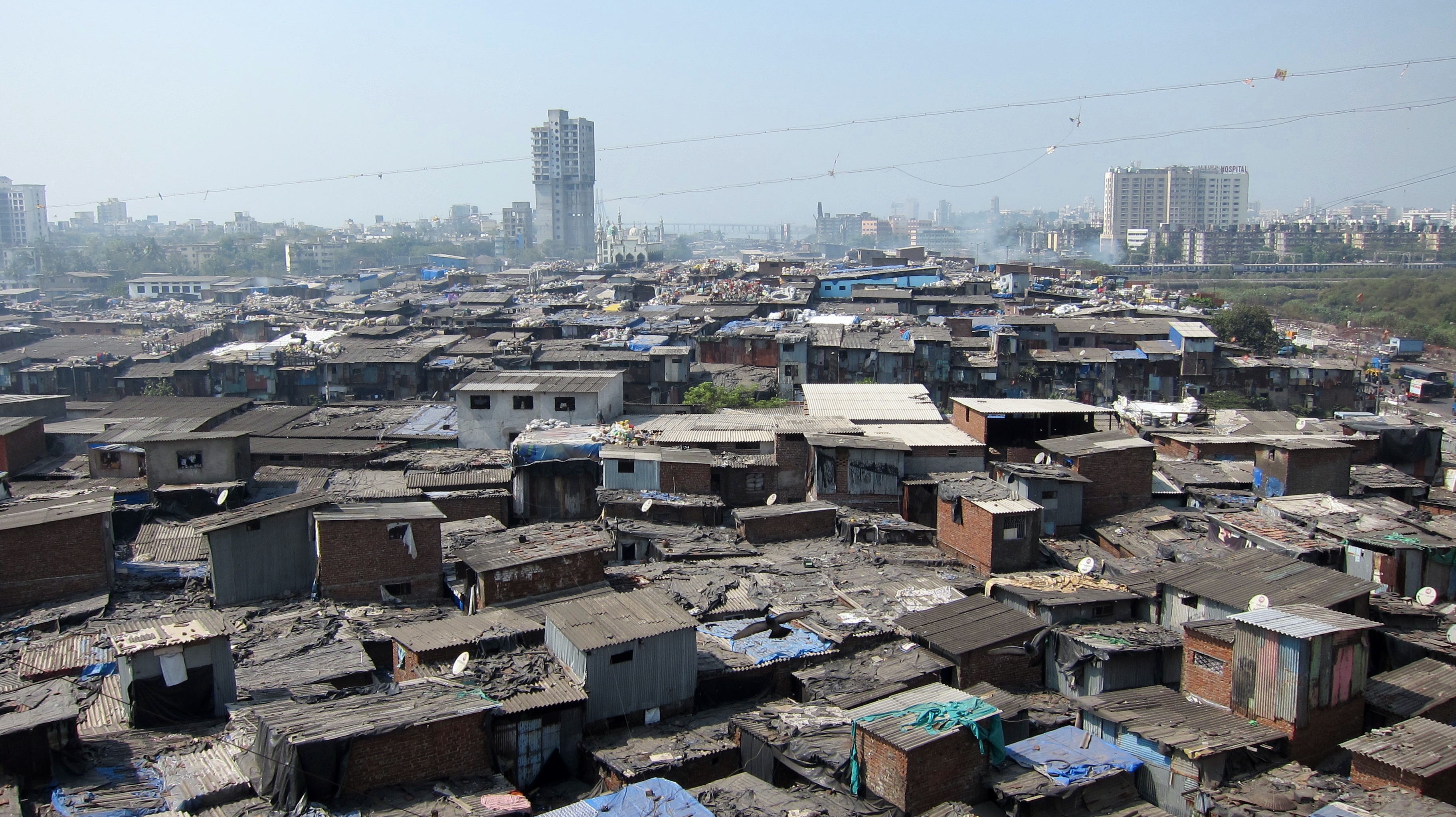
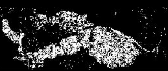
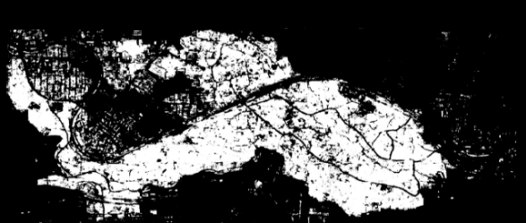
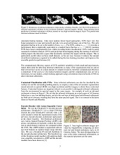
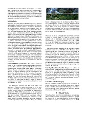
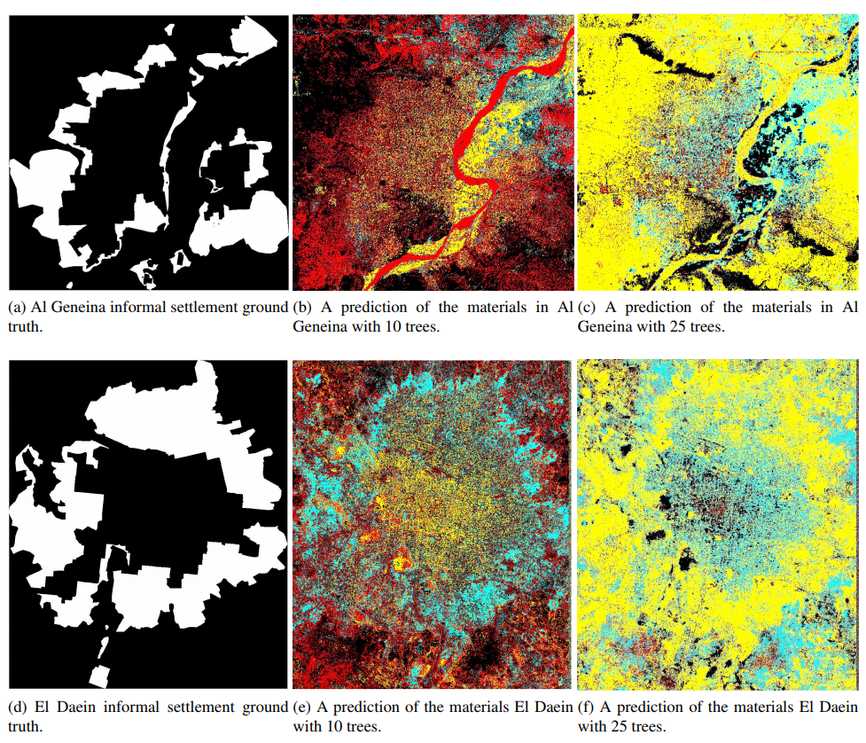
Material prediction of Mumbai with n trees = 10. Left: Sentinel-2 image of Mumbai. The area is densely populated and contains several informal settlements. Middle: Partially complete ground truth for the Informal settlements in Mumbai, white represents informal settlements and black represents environment. The Southern right hand corner is not included in this mask. Right: A CCF prediction on the Sentinel-2 L1C spectral data for determining what materials are present. Black is environment, yellow is metal, blue is shingles and red is thatch.
          Cite as: \cite{helber2018generating}

          @article{helber2018generating,
           title = {Generating Material Maps to Map Informal Settlements},
           author = {Helber, Patrick and Gram-Hansen, Bradley and Varatharajan, Indhu and Azam, Faiza and Coca-Castro, Alejandro
                     and Kopackova, Veronika and Bilinski, Piotr},
           journal = {NeurIPS 2018 Workshop on Machine Learning for the Developing World},
	   arxiv={arXiv preprint arXiv:1812.00786},
           year = {2018}
          }


          Cite as: \cite{gram-hansen2019mapping}

          @article{gram-hansen2019mapping,
            title = {Mapping Informal Settlements in Developing Countries using Machine Learning and Low Resolution Multi-spectral Data},
            author = {Gram-Hansen, Bradley and Helber, Patrick and Varatharajan, Indhu and Azam, Faiza and Coca-Castro, Alejandro
                      and Kopackova, Veronika and Bilinski, Piotr},
             journal={Proceedings of AAAI/ACM Conference on AI, Ethics, and Society},
             arxiv={https://arxiv.org/pdf/1901.00861},
            year = {2019}
          }
We released the source code and the dataset. Additional material will be published soon!
Further Figures and Experiments
Slides

Data

Code


This project was executed during the Frontier Development Lab(FDL), Europe program, a partnership between the Phi-Lab at ESA, the Satellite Applications(SA) Catapult, Nvidia Corporation, Oxford University and Kellogg College. We gratefully acknowledge the support of Adrien Muller and Tom Jones of SA Catapult for their useful comments, providing very-high-resolution imagery and ground truth annotations for Nairobi. We thank UNICEF, in particular Do-Hyung Kim and Clara Palau Montava, for valuable discussions and AIData for access to geo-located Afrobarometer data. We thank Nvidia for computation resources. We thank Yarin Gal for his helpful comments. Patrick Helber was supported by the NVIDIA AI Lab program and the BMBF project DeFuseNN (Grant 01IW17002). Bradley Gram-Hansen was also supported by the UK EPSRC CDT in Autonomous Intelligent Machines and Systems.